

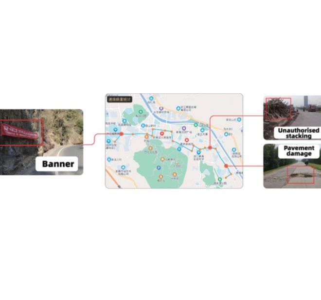
The Intelligent Road Inspection System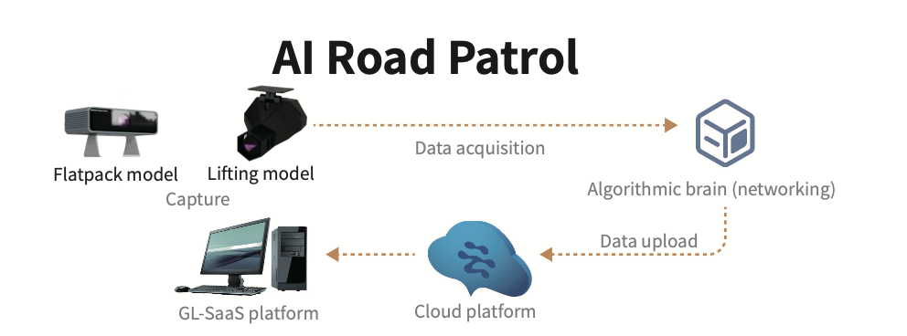
Four pain points
I. High cost of drive-through inspections
II. Difficulty in popularizing rural roads
III. Waste of human and material resources
IV. Difficulty in searching inspection records
Pain point 1: Driving inspection personnel subjectivity, repeat mileage, spend a long time, the probability of missing inspection is high, inspection costs are high.
Pain point 2: With the increase of highway mileage, it is difficult to solve the problem of staff increase, it is difficult to ensure the quality of inspection, and it is difficult to popularize the rural roads.
Pain point 3: Road patrol and maintenance patrol are different from each other, wasting human and material resources.
Pain point 4: The traditional inspection record is slow, the information is difficult to save, and the query is difficult. Xinchang County Transportation Bureau explores “HD camera equipment + AI equipment” on rural passenger buses, combines with GIS visualization technology and intelligent algorithms, and builds a one-stop “Rural Passenger Transportation + Intelligent Inspection Scenario” to improve the business process of automated road inspection and integrated operation and maintenance management.
Four scenes
Scenario 1: Vehicle Mounted Build
Scenario 2: Intelligent Inspection
Scenario 3: Closed-loop disposal
Scenario 4: Risk study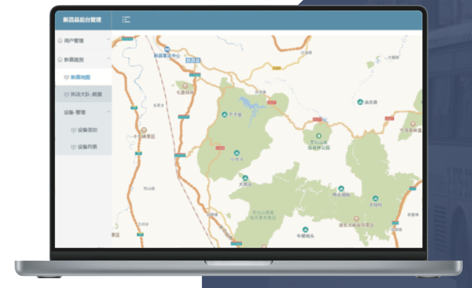
Smart Patrol consists of four scenarios
Scenario 1: Take urban and rural passenger vehicles in Xinchang County as the carrier, configure one intelligent AI vehicle brain, add one ultra-high-definition road camera, instead of manual inspection.
Scenario 2: Urban and rural passenger vehicles input the frontal 180-degree scene video to the on-board AI brain on the way, which is calculated by the AI on-board brain, and then uploads the picture + GPS information of the simulated highway defects or obstacles to the cloud platform.
Scenario 3: The command center through manual scanning, the problem by type of dispatch orders to different units, the responsible unit receives the problem report, according to the uploaded fault information in a timely manner to deal with, after processing and uploading the pictures and information after the completion of the repair, easy to query, to achieve the realization of the whole process of digital closed-loop management purposes.
Scenario 4: Through historical big data and artificial intelligence analysis, screen out road sections with high frequency of road disease and high frequency of pile-ups, and provide early warning and early engagement through risk research and judgment intelligent model. Such as the sudden appearance of sandstone and bricks on the roadside, early warning of possible illegal construction behavior.
Intelligent Patrol has initially developed three major results: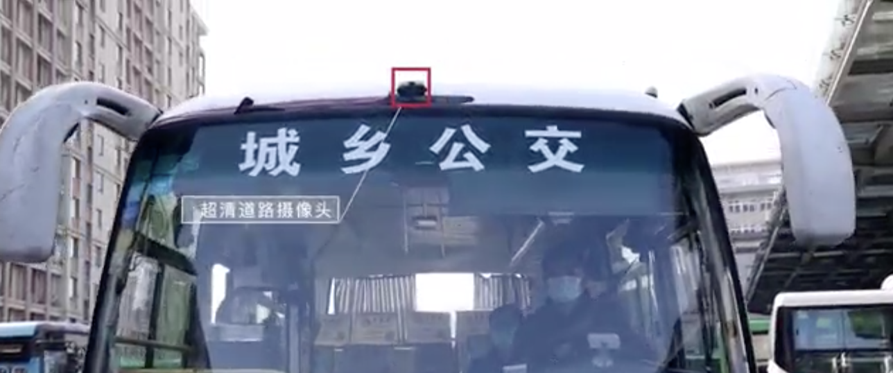
I. Establishment of a mechanism for the timely identification of road problems;
The original rely on manual inspection and mass reporting, problem discovery exists by chance, lagging, after the reform of the use of “rural passenger transport + intelligent inspection equipment”, to achieve the integration of national, provincial, county and rural roads, high-frequency inspections, so that the problem is early detection and early solution to realize the normalization of the inspection, analysis of the causes of the problem, and solve it in a timely manner, to prevent the problem from expanding.
II. Sound closed-loop disposal process
The original problem appeared after the notification in the work group, no tracking, no feedback, more departments, lack of communication; after the reform, the formation of road administration, highway maintenance categorization and disposal, real-time feedback and verification mechanism.
III. Formation of a closed-loop processing mechanism for highway inspections;
The development and introduction of Xinchang County's “Highway Inspection Specification”, “Guidelines for Disposal of Highway Inspection Problems”, the revision of “Xinchang County Rural Road Maintenance and Management Assessment Measures” and other documents to form a series of systems. Relying on cloud computing digital technology, in the future, Xinchang will be committed to the realization of the intelligent road inspection that can be participated in by all people, which will further improve the efficiency of road maintenance, save manpower, and reduce the cost.
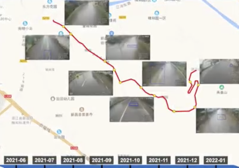
AI videography is used to monitor road conditions, which can replace traditional road patrol to handle various issues on roads.
The processing logic: Special equipment shooting is used to get abnormal information through algorithm identification, upload platform, and manual handling.
Integration of snapshot: It can replace traditional patrol, reduce manpower and material resources, and avoid uncontrollable factors such as absence of mind.
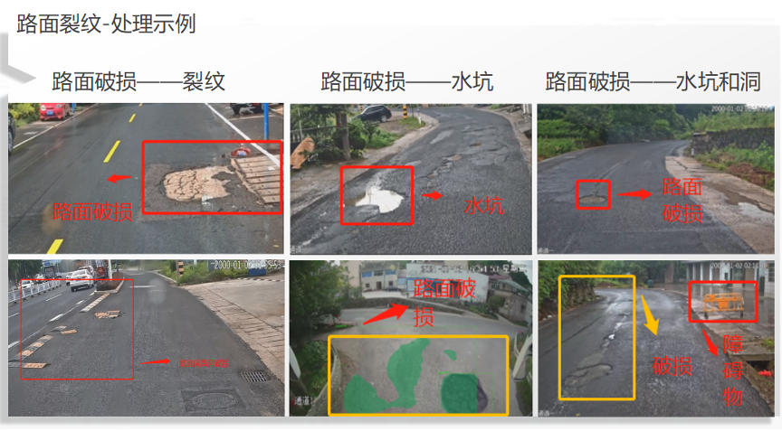
Algorithm Recognition Scenario Application: Road cracks, potholes, all kinds of illegal hanging banners, all kinds of obstacles on the road.
Data Processing: Data are stored and uploaded to the client side for unified management.
Manual Handling: Workers can directly open it, upload information, and handle the information in time through WEB.
The Golong Intelligent Road Inspection System replaces traditional manual road inspections. Utilizing various vehicle carriers equipped with high-definition, high-speed industrial cameras, the system performs real-time AI image analysis and edge computing. It intelligently captures and identifies road conditions (such as cracks, potholes, obstacles, and irregularly hung banners) and transmits the data to a cloud platform via a 4G network. This allows clients to remotely identify issues and, based on the type of fault and GPS location, manage repairs. This system overcomes the inefficiencies of traditional manual inspections, which can be affected by weather, visibility, and human error, achieving real-time, digital, visual, interactive, and intelligent road damage detection, maintenance, management, and service.
Applicable to Rural Roads, Provincial Roads, National Roads, Urban Roads, Highways etc.

System Features
1.Comprehensive Detection: Detects multiple maintenance targets including transverse cracks, longitudinal cracks, alligator cracking, potholes, and manhole height differences.
2.Support 8-megapixel resolution and simultaneous detection across three lanes.
3.Video Streaming: Real-time road condition videos can be viewed through the backend.
4.Mass Data Storage: Store real-time video recordings with expandable storage capacity.
5.Real-Time Data Transmission: Transmit detection results in real-time.
6.Mobile Access: Support Android remote viewing of real-time vehicle video footage.
7.GPS Real-Time Positioning: Offer positioning frequency of >= 1Hz with a positioning accuracy error of no more than 5 meters.
8.Mileage and Track Playback: Tracks vehicle mileage and provides driving trajectory playback.
9.AI Model Updates: Automatically download and update deep learning models.
10.All-Weather Operation: Operate reliably under various environmental conditions.
11.Flexible Data Transmission: Support TCP/IP network transmission, wireless, or 4G transmission, allowing flexible user choices.
12.Instant Detection on Startup: Begin detection as soon as the vehicle starts without needing parameter configuration.
13.Algorithm Support: Support both frontend and backend algorithms as needed.